Backend engineering for geospatial workflows
Data infrastructure that powers geospatial teams.
Spatial databases, Automated pipelines, and Web maps.
Schedule a discovery callThe challenge
Manual processes
Field crews spending hours on repetitive data collection, GPS point attribution, and coordinate transformation tasks. Manual CAD-to-GIS conversions, boundary calculations, and parcel data processing consume billable hours that could be automated through custom Python scripts or cloud tools.
Data chaos
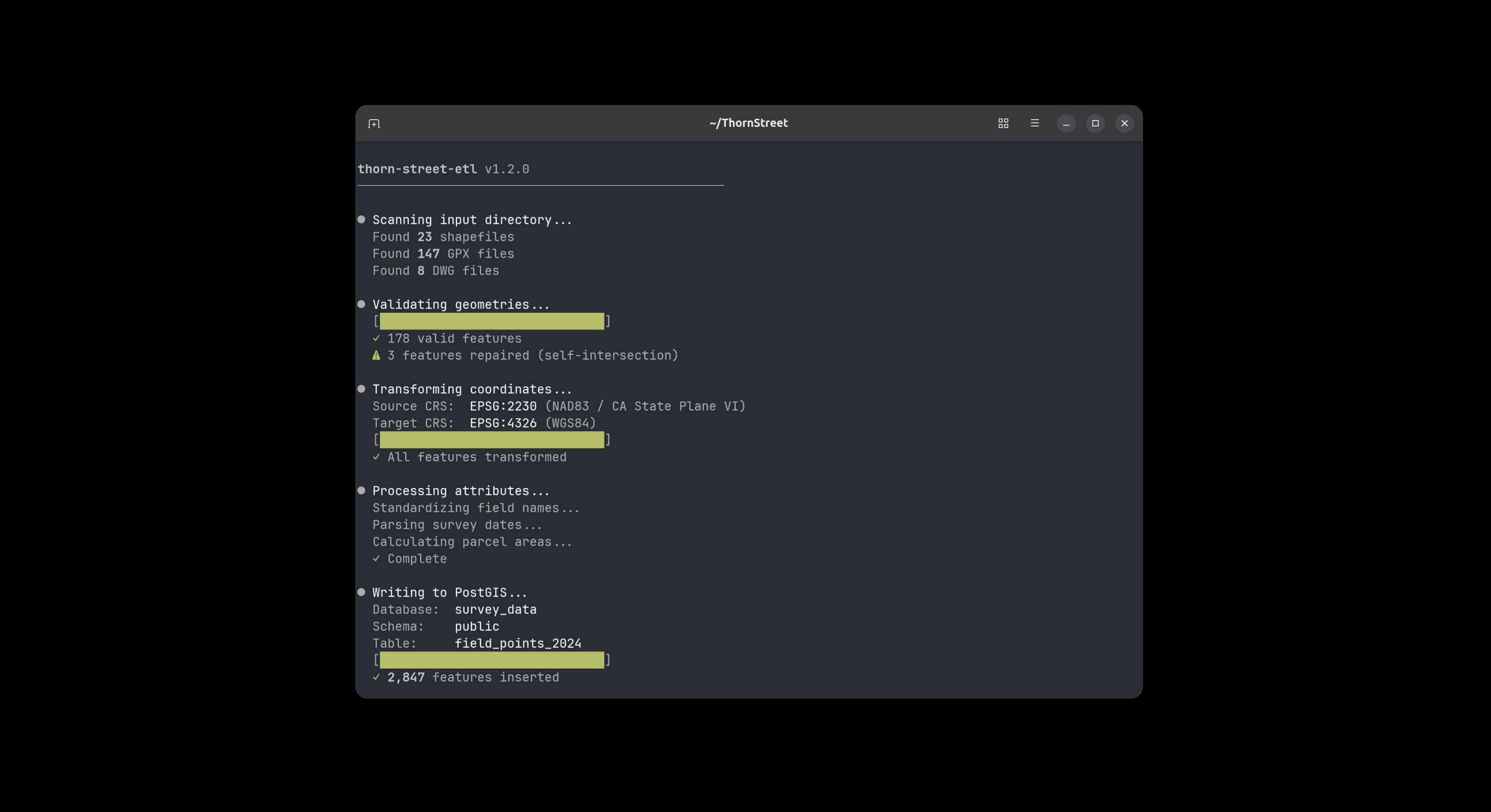
Every project arrives in a different format: shapefiles, KML, DWG, GPX, GeoJSON, or proprietary survey formats. Building custom ETL pipelines, coordinate system transformations, and data validation workflows for each client's unique specifications becomes a bottleneck that delays project delivery.
Client expectations
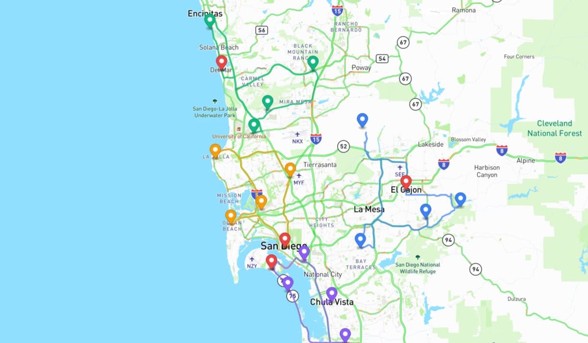
Modern clients expect interactive web maps, real-time project dashboards, and self service data portals instead of static PDF deliverables. They want mobile responsive viewers, live GPS tracking, and cloud based collaboration tools that traditional GIS workflows weren't designed to deliver.
Technical solutions
Solutions that integrate with your existing workflows.
Data Infrastructure
Spatial databases and pipelines that scale. From schema design to automated ETL, I build systems that ingest messy data and make it queryable.
- • Spatial database design
- • ETL pipelines
- • Automated validation & QA/QC workflows

Automation
Turn repetitive field data tasks into automated workflows. Python scripts and custom tools that free up your billable hours for high value work.
- • CAD-to-GIS conversion
- • Batch processing & calculations
- • Integration with existing GIS systems
Web Applications
Exceed client expectations with interactive web maps and real-time dashboards. Mobile responsive portals that replace static PDFs with live data access.
- • Client data portals
- • Interactive web maps
- • Real-time project dashboards
How we work
Discovery
We discuss your challenge and timeline. Clear assessment of fit.
Proposal
Fixed scope and price. No surprises or scope creep.
Delivery
Weekly updates and working demos. Your deadlines are real.

Meet your engineer.
I'm Connor, a software engineer with a math background and defense industry experience in geospatial systems. When you work with Thorn Street, you work directly with me.
More about my background →Engagement options
Project based
Fixed scope and price for defined deliverables. Best for pipeline builds, automation projects, and portal development.
Start a project →Retainer
Monthly hours for ongoing development needs. Best for continuous improvements, maintenance, and multiple projects.
Learn more →